COhave research
COhave research
Modeling and simulation of user movements with bio-inspired computing.
Mobile applications for sensing and collection data.
Social Pattern Discovery for GPS Datasets
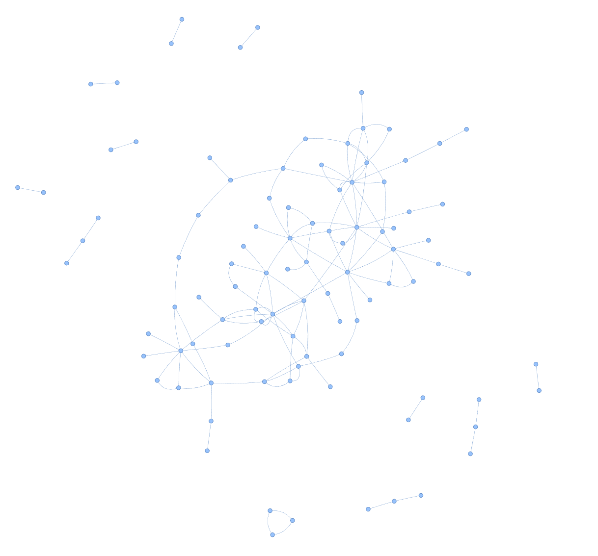
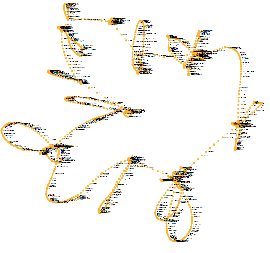
This work introduces a method to analyze human mobility and social interactions, highlighting the use of geohash codes for spatial clustering and the identification of social encounters with and without time constraints. Our approach uncovers "followers" by tracking how people move to subsequent geohashes within a specific time interval, revealing patterns of coordinated mobility. Our analysis includes the construction of a social graph visualizing individual connections.
The Geolife GPS dataset, which comprises 17,621 trajectories covering approximately 1.2 million kilometers and spans over 48,000 hours across five years. Our approach, adaptable to various GPS datasets, converts movement trajectories into a series of geohash codes, enhancing the analysis of social behaviors and connections. Remarkably, despite the dataset's size, our analysis, effectively reduces these complex interactions into a simplified representation consisting of only 96 nodes and 131 edges. This reduction to a manageable network graph underscores our method's efficiency in capturing the essence of social connections within such a large dataset.
Maroš Čavojský. Social Pattern Discovery for GPS Datasets. 28th International Conference on Knowledge-Based and Intelligent Information & Engineering Systems (KES) 2024, tba.
Cavojsky, Maros. "Identifying Bus Lines and Outliers in Bus Routes of Rio de Janeiro." Procedia Computer Science 225 (2023): 3764-3773.
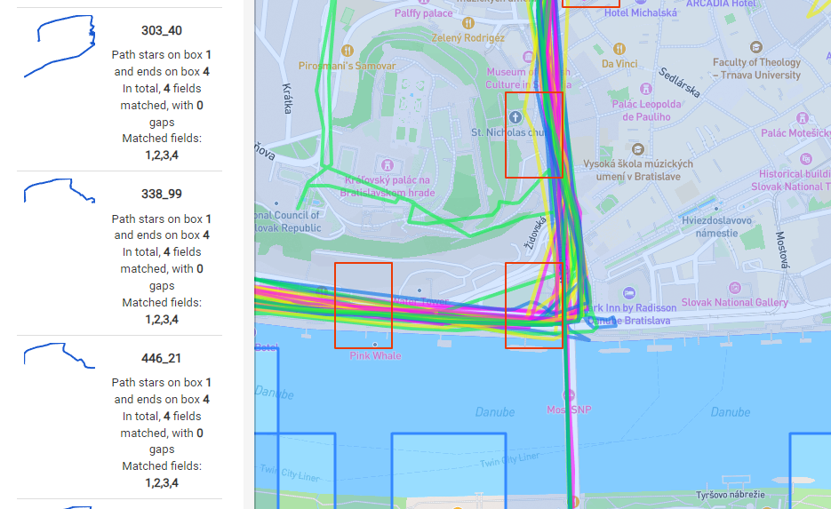
User Experience in GPS Trajectory Search using Pattern
We have proposed, implemented and compared several approaches for user movement (trajectory) extraction. Unlike other approaches, our approaches are purely based on WiFi sensing without the knowledge of user's physical location. This is a favorable approach in scenarios that aim at high energy efficiency. We only collect WiFi information passively, i.e. we only listen to broadcast beacons and do not transmit any probe requests.
Maroš Čavojský, Martin Drozda. User Experience Meets GPS Trajectory Search. IEEE International Conference on Systems, Man, and Cybernetics (SMC) 2023 Maroš Čavojský, Martin Drozda. Search by Pattern in GPS Trajectories. EAI MobiCASE 2022, 13th EAI International Conference on Mobile Computing, Applications and Services. Springer Nature Switzerland, 2022. p. 117-132.
Comparison of GPS Trajectories with the Needleman-Wunsch Algorithm
Our goal was to test if the Needleman-Wunsch algorithm (NWA) for sequence alignment can be efficiently applied to comparing user trajectories, where user locations are provided by Global positioning system (GPS). We proposed several adjustments to this algorithm. Our results show that NWA can be successfully applied to user trajectory comparison.
Maroš Čavojský, Martin Drozda, Zoltán Balogh. Analysis and Experimental Evaluation of the Needleman-Wunsch Algorithm for Trajectory Comparison. Expert Systems with Applications, 2020, Elsevier. Maroš Čavojský, Martin Drozda. Comparison of User Trajectories with the Needleman-Wunsch Algorithm. MobiCASE 2019, 10th EAI International Conference on Mobile Computing, Applications and Services. Springer, Cham. 2019. p. 141-154.
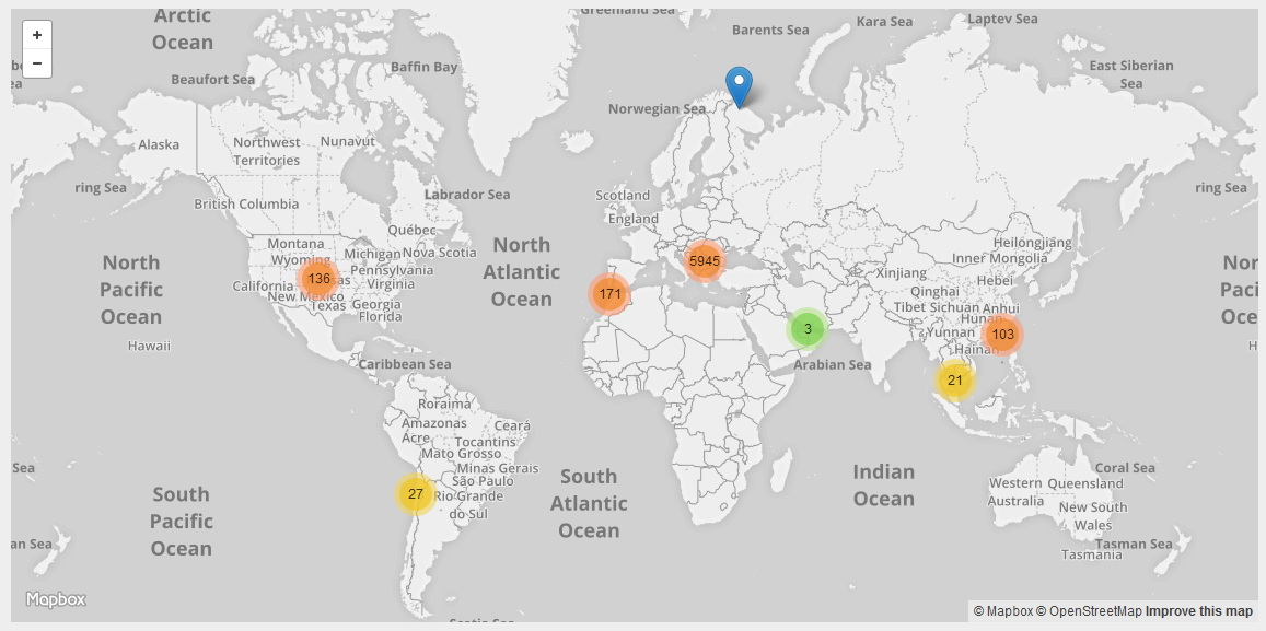
4+ years, 500+ devices,
50 000 000+ GPS, WiFi records
From our experiments we offer data set, that we collected with 455 mobile devices distributed among our students at university. Locations and WiFi networks are collected worldwide.
| Year | GPSv1 | GPSv2 | WiFi |
|---|---|---|---|
| 2015 | 6 530 019 | - | - |
| 2016 | 13 183 118 | 460 199 | 12 287 597 |
| 2017 | 441 786 | 463 671 | 13 425 877 |
| 2018 | 83 633 | 212 971 | 7 439 015 |
| 2019 | - | 54 403 | 1 622 007 |
| 2020 | - | 13 145 | 622 945 |
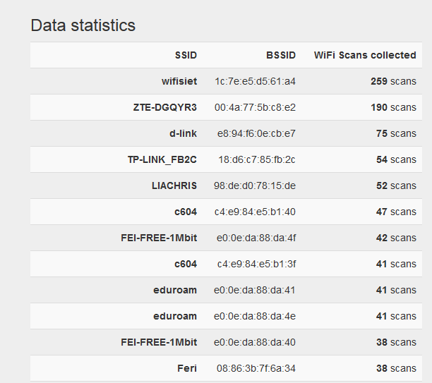
You can download report from WiFi dataset analysis written in Slovak language here.
Modeling movement based on WiFi
We have proposed, implemented and compared several approaches for user movement (trajectory) extraction. Unlike other approaches, our approaches are purely based on WiFi sensing without the knowledge of user's physical location. This is a favorable approach in scenarios that aim at high energy efficiency. We only collect WiFi information passively, i.e. we only listen to broadcast beacons and do not transmit any probe requests.
Maroš Čavojský, Marek Uhlar, Marian Ivanis, Martin Molnar, Martin Drozda. User Trajectory Extraction Based on WiFi Scanning. 2018 6th International Conference on Future Internet of Things and Cloud Workshops, pp. 115-120, IEEE, 2018
Trajectory recording using WiFi scanning
Mobile devices are equipped with a GPS receiver, but its frequent use can cause a high battery drain. Our design of continuous location tracking aims at providing a reasonable trade-off between energy consumption, location acquisition accuracy. We use WiFi scanning for decisions about when to start using GPS receiver. The experiments show that our design provides significant energy savings when compared to other continuous location tracking alternatives. Maroš Čavojský and Martin Drozda. Energy Efficient Trajectory Recording of Mobile Devices Using WiFi Scanning. The First International Workshop on Crowd Intelligence for Smart Cities. Proc. of 2016 Intl. IEEE Conferences on UIC/ATC/ScalCom/CBDCom/IoP/SmartWorld Congress, pp. 1079-1085, IEEE, 2016.
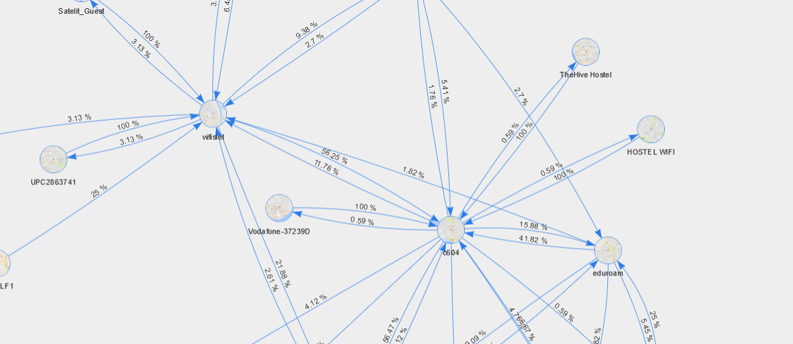
WiFi Places Markov Chain (BiGram) Try it
Explore device collected statistics
Explore deep statistics about device collected data. Useful as start for other tools, when you discover dates and times of sensing of device.